Fortifications of Valletta - The Best Mobile Map and Guide Tool if you visit Malta!

Maltaguide.pro Home icon
Maltaguide.pro Places of Interest icon
Text to Speech
Maltaguide.pro, Home Icon
Icon of Malta Map Places of interest
Menu places of interest Malta
Book you trip Icon menu
Back icon, maltaguide.pro
Go to content
Monument - Fortifications of Valletta
Fortifications of Valletta

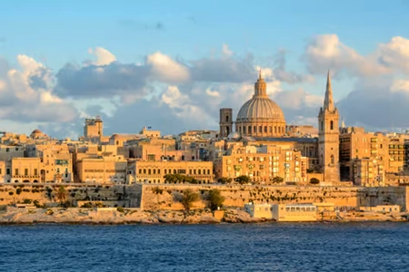
At present, Valletta is surrounded by about 5km of fortification walls, built by the Order of St John in about five years time. The Order of St John also built about 15 km of fortification walls around the Grand Harbour and Marsamxett Harbour, evolving and increasing in strength during the 268 years the order was in Malta.

App info: In our app you will find the location, address, opening hours and admission / entrance fee of this spot. If you use the app, you will find additional information and news about this spot on this page.

The direct reason for the fortifications around Valletta was, of course, the Great Siege of 1565. This Ottoman invasion of Malta utterly destroyed the area what is now called the Three Cities, where the Order of St John and the Maltese population had defended themselves against the ottomans.

After the Great Siege a new capital city was needed, and Valletta arose out of the ashes of disaster. These fortification walls are also interpreted as an embodiment of fear, fear of the Ottomans, should they return.At the tip of Valletta stands Fort St Elmo, where already stood a medieval watchtower, before the arrival of the Order of St John in 1530.

Address and street / location can be found on our map, click on Guide in the menu bar and you will get a map with markers.
Additional information

St. Michael Bastion, St. andrew Bastion, Vendome Bastion, Fort St. Elmo, St. Lazarus Bastion, St. Christopher Bastion, St. Barbara Bastion, St. Peter and Paul Bastion, St. James Cavalier, St. James Bastion and St. John Bastion together with the great defensive walls, they are all part of the Valletta fortification (1566 - 1571).
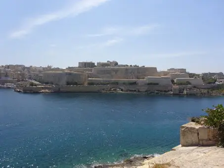


A clear view of the second defense line. Directly at Valletta. As long as you have enough money for your men and ammunition, no enemy will capture Valletta.


The defense lines to defend threats from land can be clearly seen on this old map.


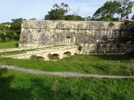
The first defensive wall in Floriana. (1635 -1700) The bridge was built in the ditch for the old railway.


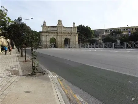
From the land, Valletta was only accessible to first pass the Porte des Bombes, and then the gate of Valletta.


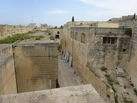
Restoration of the Bastion and defensive walls in Floriana (2020).


This Fortifications of Valletta page is part of “The Malta Magazine”.

This magazine is for every resident and visitor to the country of Malta. But is also educational and for anyone interested in Malta.  The Malta Magazine highlights the past and present of specific subjects and/or places of interest with the help of extensive information and photos.

As a tool during your journey of discovery through Malta, you can use our information services free of charge. You can do this in two ways, via our website https://maltaguide.pro or our app depending on your operating system, Google Play or Apple Store. Both give you the same information.

“The Malta magazine” is the best, ultimate and most comprehensive magazine you can get of Malta.

The magazine is growing fast and will soon contain more than 350 interesting topics.

Find and discover interesting sights and discover the many historical secrets of the country Malta. Find all things to do and places of interest in your exploration.

“The Malta magazine” is also convenient whether you are walking, driving a car, or using the hop-on and hop-off bus trip, boat trip, etc.

“The Malta magazine” provides you with general information about the sights, Malta’s beauty, secrets, history and culture, its architecture, fortifications, etcetera and specific information as: what took place here?; When was it built and by whom?; What are the functions of all these.

“The Malta magazine” describes also religious subjects, museums, parks, places of interest, public toilets and much more useful information. Interesting texts set up by local experts and additional informative photos make this app distinctive.

“The Malta magazine” answers many questions and shows in an easy way to navigate way where the sights are located. A great landmap and citymap made specifically for you, is a great tool. You can immediately see where you are and where the sights are.

In this "Malta Magazine" you will find the location, address, opening hours and admission / entrance fee, general additional information and news about the spot.

Everything in “The Malta magazine” is easy to operate, without any knowledge and suitable for young and old.

“The Malta magazine” is free while you normally would pay for a guided tour, you may enjoy navigating through Malta on your own terms.

“The Malta magazine”  is constantly maintained about: attractions which are closed due to renovation, changed entrance fees or opening times, etc. This maintenance costs a lot of money. However, it has been decided not to include annoying advertisements. The “The Malta magazine” has no hidden costs.

The skillfielly texts are written by local experts and additional informative photos make  “The Malta magazine” information provision distinctive.
Back to content