Dockyard Creek Malta - The Best Mobile Map and Guide Tool if you visit Malta!

Go to content
A general photo of Dockyard Creek
Dockyard Creek

The Order of St. John established its maritime activities in this creek, from maintenance to construction of galleys.

App info: In our app you will find the location, address, opening hours and admission / entrance fee of this spot. If you use the app, you will find additional information and news about this spot on this page.

After Malta had asked the British to help them expel the French from the island, the British period began in 1800, two years after the French occupation.

With the loss of Menorca (Spain), Malta became the largest Royal Navy port in the Mediterranean and a drydock was soon built, the first Royal Dockyard outside of Great Britain. This dock is called Dock No 1.

Very quickly the area was completely used for maritime activities and was extended to the French Creek.

An increase in the fleet also meant that there was a need for more facilities such as warehouses, a rope-making shop, accommodation for officers and men, workshops, shops, a kitchen, a bakery, etc, etc.

During the Second World War a massive attack by 60 dive bombers took place on the shipyard in January 1941 but only one bomb hit the target. However, the bombing by German and Italian bombers did not stop.

In April 1942, the Admiral supervisor reported that, due to the ongoing bombing, the Royal Dockyard could no longer function.

In 1979, the shipyard, the base of the Royal Navy, was closed and the Royal Navy withdrew from Malta. Malta was independent!

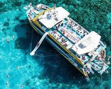
Today this creek is mainly used to berth boats and yachts in the marina. At the beginning of the creek there is space  especially  for super luxurious yachts with a length of maximum 135 metres.
Complete service is available for the berth, from complete bunkering, provision, technical services and the renting of a captain.

At the end of the creek there is dock no 1, the first drydock of Malta.

There is little to be found from the British period.
Address and street / location can be found on our map, click on Guide in the menu bar and you will get a map with markers.
Book: Buy tickets for place of interest. sights, hop on hop off buses, exhibitions, safari, etc or book and tour.
Additional information


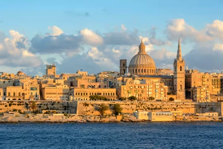
Photo below: On the left you see Fort St. Elmo with Victoriosa (Birgu) behind it. On the right you will see Sengela. Dock number 1 is located at the end.


This Dockyard Creek page is part of “The Malta Magazine”.

This magazine is for every resident and visitor to the country of Malta. But is also educational and for anyone interested in Malta.  The Malta Magazine highlights the past and present of specific subjects and/or places of interest with the help of extensive information and photos.

As a tool during your journey of discovery through Malta, you can use our information services free of charge. You can do this in two ways, via our website https://maltaguide.pro or our app depending on your operating system, Google Play or Apple Store. Both give you the same information.

“The Malta magazine” is the best, ultimate and most comprehensive magazine you can get of Malta.

The magazine is growing fast and will soon contain more than 350 interesting topics.

Find and discover interesting sights and discover the many historical secrets of the country Malta. Find all things to do and places of interest in your exploration.

“The Malta magazine” is also convenient whether you are walking, driving a car, or using the hop-on and hop-off bus trip, boat trip, etc.

“The Malta magazine” provides you with general information about the sights, Malta’s beauty, secrets, history and culture, its architecture, fortifications, etcetera and specific information as: what took place here?; When was it built and by whom?; What are the functions of all these.

“The Malta magazine” describes also religious subjects, museums, parks, places of interest, public toilets and much more useful information. Interesting texts set up by local experts and additional informative photos make this app distinctive.

“The Malta magazine” answers many questions and shows in an easy way to navigate way where the sights are located. A great landmap and citymap made specifically for you, is a great tool. You can immediately see where you are and where the sights are.

In this "Malta Magazine" you will find the location, address, opening hours and admission / entrance fee, general additional information and news about the spot.

Everything in “The Malta magazine” is easy to operate, without any knowledge and suitable for young and old.

“The Malta magazine” is free while you normally would pay for a guided tour, you may enjoy navigating through Malta on your own terms.

“The Malta magazine”  is constantly maintained about: attractions which are closed due to renovation, changed entrance fees or opening times, etc. This maintenance costs a lot of money. However, it has been decided not to include annoying advertisements. The “The Malta magazine” has no hidden costs.

The skillfielly texts are written by local experts and additional informative photos make  “The Malta magazine” information provision distinctive.
Back to content