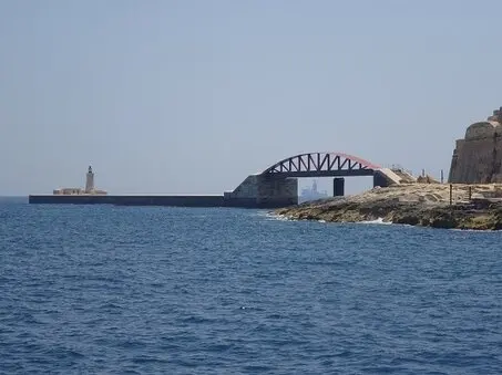


Breakwater of the Grand Harbour
Once the breakwater and the remnants of its bridge are passed, the Grand Harbour opens up in all its grandeur and one can easily understand why this harbour has been described since the earliest days of writing.
Among others, the Greek geographer Strabo and the Latin writer Pliny the Elder already made mention of Malta and its sheltered harbours. In circumference the harbour is 15 km long and its length measures 4 km across. At places it can be 30 m deep!
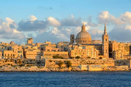
The fortifications of the Grand Harbour are mainly the creation of the Knights of St John, although during the British period (1800-1964) many modifications were carried out.
The once mighty walls are now dwarfed by modern cruise liners, whose upper deck often reaches the top of the walls. Nevertheless the harbour fortifications never cease to amaze.
Address and street / location can be found on our map, click on Guide in the menu bar and you will get a map with markers. |